NAV Functions
Option Menu
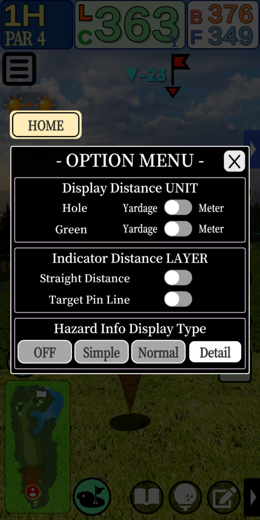
Tap the Options Menu icon in the upper left corner of the navigation screen to
The Option Menu window will open.
The Option Menu allows you to set the display items in the NAVS.
Icon

Option Menu Window
Home Screen

Exits the navigation system and returns to the Home Screen.
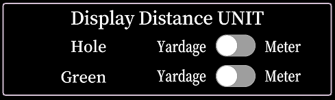
Display Distance Unit
Sets the display distance unit for distance and elevation difference.
Separate units can be set for holes and greens.
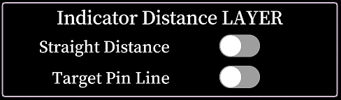
Indicator Distance Layer
Sets the display settings for “Straight Distance Circle” and “Target Pin Line”.
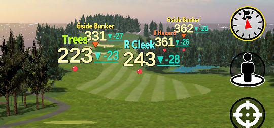
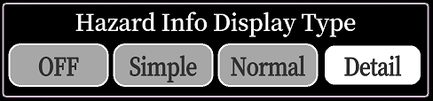
Hazard Information Display Type
Sets the display type of hazard information from 4 types: “OFF”, “Simple”, “Normal”, and “Detailed”.
Display distance unit
The display distance unit can be set separately for “distance unit on the hole” and “distance unit on the green.
Green subject to change
Only two areas of the green are subject to display distance changes: the grid and the pin-sheet values on the green, which are displayed in the green strategy mode.
【Green:Yard】
【Green:Meter】
Hole subject to change
All the displayed distances for holes are subject to change, except for the greens.
Distance in the score input dialog is also applicable.
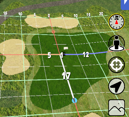
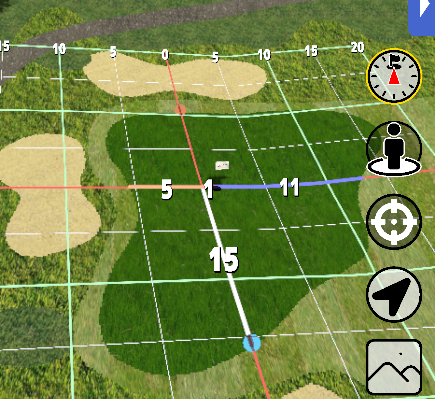
Indicator Distance Layer
The Indicator Distance Layer allows you to set the display settings for two layer objects: “Straight Distance Circle” and “Target Pin Line”.
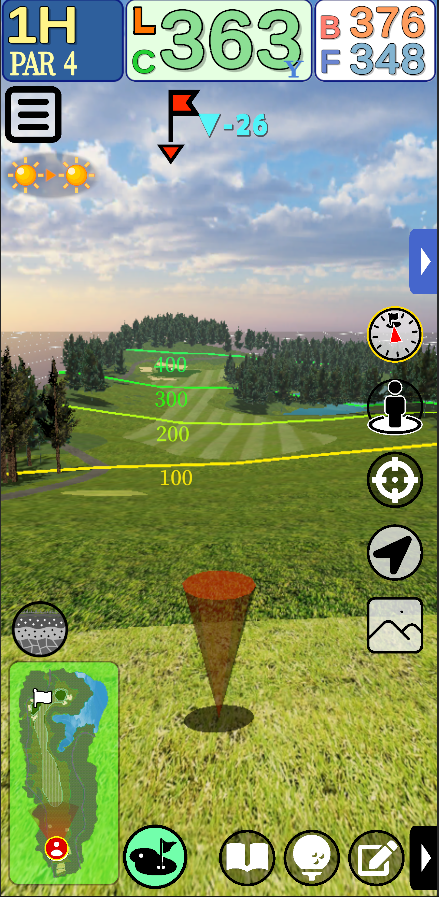
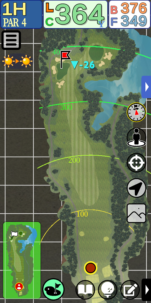
Straight Distance Circle
Displays a line showing the straight line distance from the current location to a radius of 100, 200, 300, 400, or 500 (yards/meters).
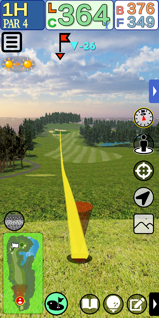
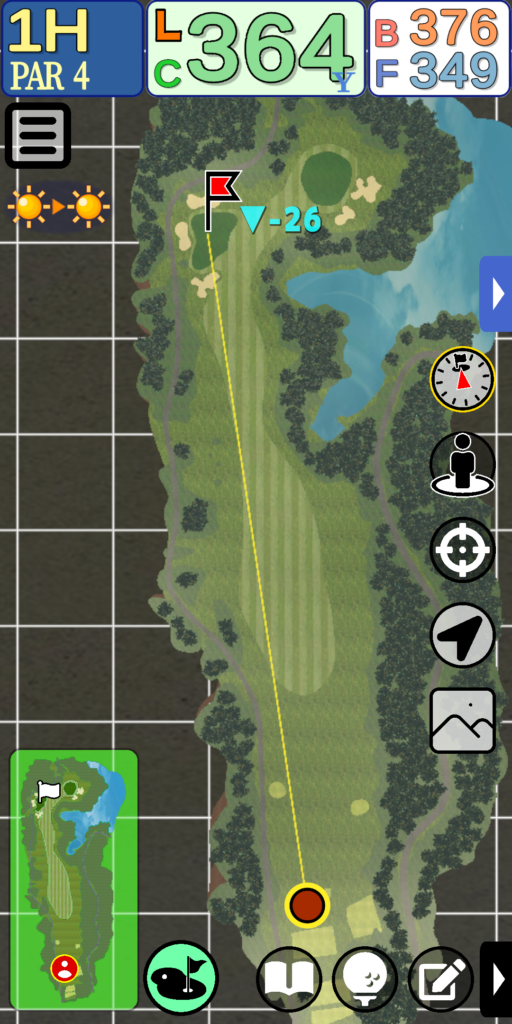
Target Pin Line
Displays a line connecting the current location to the pin.
The line is displayed along the undulations of the terrain.
Hazard Information Display Type
Hazard Information Display Type allows you to select from four types of display: “OFF,” “Simple,” “Normal,” and “Detailed.
*Level differences are not displayed in “Competition Mode.
OFF
Hazard information is not displayed.
Simple
Displays the distance to the hazard.
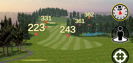
Normal
Displays the distance to the hazard and the height difference.
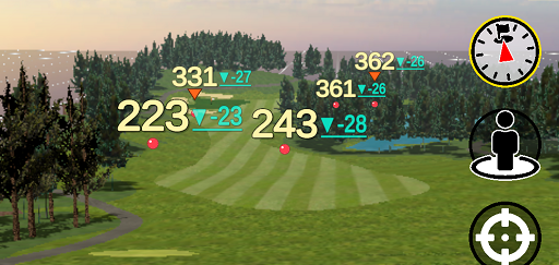
Detail
Displays the hazard name, distance and height difference.