
NAV Functions
Screen UI Description
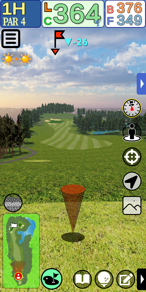
Header Information
Displays information such as current hole/par count/distance to pin, etc.

Option

Configure the display settings for the navigation system.
Pin Information

Displays information on the direction of the pin and altitude difference from the current location.
Weather Forecast

Pinpoint weather forecast.
The current time and the weather one hour later are displayed.
When touched, detailed information is displayed in a dialog box.
Display of main icons ON/OFF

The display of the main icons is turned ON/OFF.
Main icons
Target View”, “Reset Viewpoint”, “3-Point Survey”, “Use GPS”, and “Heat Map” icons are called “Main Icons”.
Target View

Press the button to enter Target View mode.
Reset Viewpoint

Press the button to move the viewpoint to a position where it is easier to grasp the current location to the pin.
The behavior differs for each mode.
3-point surveying

Places controllers at three points (current location – midpoint – pin) and displays the distance between the three points.
GPS Use

Press the button to acquire location information from GPS and reflect the current location in the navigation system.
Heat Map

Displays the relative height difference from the current location by color.
Display of sub icons ON/OFF

Turns the display of sub icons ON/OFF.
Sub icons
The “Scorecard,” “Register Location,” and “Enter Score” icons are called sub icons.
Scorecard

Click the button to display the scorecard.
Register Location

button registers the current location.
Score Input

button displays the score input dialog.
Green Strategy

Press button to enter green strategy mode.
Minimap
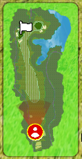
A mini-map showing the entire hole.
Pressing the minimap toggles between 2D and 3D mode.
Cross Sectional Map

Press button to enter cross-sectional view mode.